


Voting District 10114, Los Angeles County, California
About
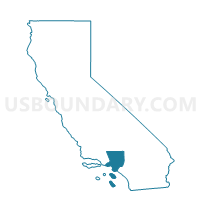
Outline

Summary
| Unique Area Identifier | 533312 |
| Name | Voting District 10114 |
| County | Los Angeles County |
| State | California |
| Area (square miles) | 2.85 |
| Land Area (square miles) | 2.85 |
| Water Area (square miles) | 0.00 |
| % of Land Area | 99.89 |
| % of Water Area | 0.11 |
| Latitude of the Internal Point | 33.98017610 |
| Longtitude of the Internal Point | -118.21511210 |
Maps


Graphs
Select a template below for downloading or customizing gragh for Voting District 10114, Los Angeles County, California


Neighbors
Neighoring Voting District (by Name) Neighboring Voting District on the Map
- Voting District 10105, Los Angeles County, CA
- Voting District 10111, Los Angeles County, CA
- Voting District 10117, Los Angeles County, CA
- Voting District 10132, Los Angeles County, CA
- Voting District 10150, Los Angeles County, CA
- Voting District 10408, Los Angeles County, CA
- Voting District 10411, Los Angeles County, CA
- Voting District 10414, Los Angeles County, CA
- Voting District 10417, Los Angeles County, CA
Top 10 Neighboring County Subdivision (by Population) Neighboring County Subdivision on the Map
Top 10 Neighboring Place (by Population) Neighboring Place on the Map
- South Gate city, CA (94,396)
- Florence-Graham CDP, CA (63,387)
- Huntington Park city, CA (58,114)
- Bell city, CA (35,477)
- Maywood city, CA (27,395)
- Cudahy city, CA (23,805)
- Walnut Park CDP, CA (15,966)
- Vernon city, CA (112)
Top 10 Neighboring Unified School District (by Population) Neighboring Unified School District on the Map
Top 10 Neighboring State Legislative District Lower Chamber (by Population) Neighboring State Legislative District Lower Chamber on the Map
Top 10 Neighboring State Legislative District Upper Chamber (by Population) Neighboring State Legislative District Upper Chamber on the Map
Top 10 Neighboring 111th Congressional District (by Population) Neighboring 111th Congressional District on the Map
Top 10 Neighboring Census Tract (by Population) Neighboring Census Tract on the Map
- Census Tract 5336.03, Los Angeles County, CA (6,617)
- Census Tract 5349, Los Angeles County, CA (6,569)
- Census Tract 5357.01, Los Angeles County, CA (6,050)
- Census Tract 5336.02, Los Angeles County, CA (5,420)
- Census Tract 5345.01, Los Angeles County, CA (5,201)
- Census Tract 5355.02, Los Angeles County, CA (4,958)
- Census Tract 5348.03, Los Angeles County, CA (4,930)
- Census Tract 5343.01, Los Angeles County, CA (4,636)
- Census Tract 5336.01, Los Angeles County, CA (4,484)
- Census Tract 5331.04, Los Angeles County, CA (4,356)
Top 10 Neighboring 5-Digit ZIP Code Tabulation Area (by Population) Neighboring 5-Digit ZIP Code Tabulation Area on the Map
- 90201, CA (101,279)
- 90280, CA (94,396)
- 90255, CA (75,066)
- 90001, CA (57,110)
- 90270, CA (27,372)
- 90058, CA (3,223)